
Emerald Coast Route: Complete Itinerary and Best Landscapes
- The Emerald Coast route connects Cancale to Cap Fréhel along approximately 80 km of the Brittany coastline
- Allow 1 to 2 days to travel the route at a leisurely pace, with stops in Saint-Malo, Dinard, and Cap Fréhel
- Easily fits into a 5 to 7-day North Brittany itinerary, combined with the Pink Granite Coast
- Accessible by car, bike (certain sections), or motorhome, with dedicated service areas along the route
- The most stunning panoramas are found at Cap Fréhel and along the coastal path between Saint-Malo and Dinard
The Emerald Coast route winds along the Breton coastline between Cancale and Cap Fréhel, spanning about 80 kilometers. It is one of the most spectacular routes in northern Brittany, featuring cliffs, fine sandy beaches, and traditional fishing villages. For travelers planning a North Brittany itinerary, this route is ideally experienced over one or two days, with essential stops in Saint-Malo, Dinard, and Cap Fréhel. It also serves as an excellent starting point or a central stage for a broader 5, 7, or 10-day Brittany tour, whether you are traveling by car, motorhome, or even by bike on certain stretches. Here is a detailed breakdown of the route, the landscapes you cannot miss, and the best options for organizing your road trip based on the length of your stay.
The Emerald Coast Route Layout
The Emerald Coast gets its name from the unique color of the sea in this area—an emerald green caused by the nature of the seabed and the changing light of the English Channel. The historic route connects Cancale, famous for its oyster farms, to Cap Fréhel, a rocky promontory rising more than 70 meters above the sea.
Between these two points, the road follows the Bay of Mont-Saint-Michel before passing through Saint-Malo, a walled corsair city, and then crossing the Rance estuary to reach Dinard, a seaside resort popular since the 19th century for its Belle Époque villas. The journey continues toward Saint-Lunaire, Saint-Briac-sur-Mer, Lancieux, and Saint-Cast-le-Guildo before arriving at Cap Fréhel.
Unlike a coastal highway, this is not a single, continuous main road but a series of departmental roads (notably the D201 and D786) that closely follow the coastline. This means more detours and slower speeds through towns during high season, but it is precisely this that provides endless viewpoints over the ocean. The full drive takes about 1.5 to 2 hours without stops, but the true appeal of this route lies in the stops available at every turn.
Must-See Highlights
Saint-Malo is the centerpiece of the first part of the journey. The ramparts surrounding the old town (intra-muros) offer a walk of about 1 hour 45 minutes with views of the Grand Bé and Petit Bé islands, which are accessible on foot at low tide. Sillon Beach, located just below the ramparts, is one of the longest in Brittany.
Crossing the Rance estuary toward Dinard, you will find a town renowned for its “Clair de Lune” promenade and its villas dating back to the era when the Anglo-American aristocracy made it their summer getaway. The coastal path running between Saint-Malo and Dinard (accessible via shuttle boat or by road) allows you to admire the bay from a different perspective.
Further west, Saint-Briac-sur-Mer and its sheltered beaches are perfect for families, while Saint-Cast-le-Guildo offers one of the most beautiful beaches on the coast, with an unobstructed view all the way to Cap Fréhel.
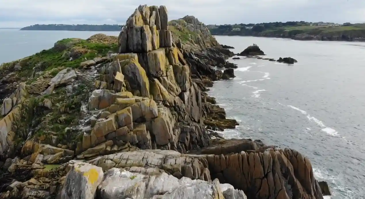
Cap Fréhel marks the end of the journey: pink sandstone cliffs plunging into the sea, a listed lighthouse, and a viewpoint that, on clear days, allows you to spot the Chausey Islands and sometimes the English coast. It is also a protected area home to seabird colonies, which are particularly active in the spring.
How much time to plan based on your itinerary
The amount of time you should dedicate to the Emerald Coast depends on the overall structure of your Brittany trip.
For a 3-day Brittany itinerary or a short stay, it is realistic to focus on Saint-Malo and Dinard, with an extension to Cap Fréhel as an additional half-day trip.
In a 4-day or 5-day Brittany itinerary, the Emerald Coast can take up 1.5 to 2 full days, combining coastal walks with the discovery of seaside towns before heading inland or toward the Pink Granite Coast.
For a 7-day Brittany itinerary, this route fits naturally at the beginning or end of your circuit, especially if you are arriving from Rennes or Paris. It pairs well with a visit to Dinan, located less than 30 minutes from Dinard.
On a 10-day or 15-day Brittany itinerary, the Emerald Coast becomes one of many stops on a complete tour of the region, potentially including southern Brittany and the Gulf of Morbihan. In this case, don’t hesitate to slow down: spending two nights on this stretch of coast—one in Saint-Malo and one near Saint-Cast or Dinard—allows you to better enjoy the beaches and coastal paths without backtracking.
Finally, for a Brittany-Normandy itinerary, the Emerald Coast serves as the perfect link, as Cancale is less than an hour from Mont-Saint-Michel, the natural gateway between the two regions.
Car, motorhome, or bike: which mode of transport to choose?
The Emerald Coast route is suitable for several modes of travel depending on your desired pace.
By car, you have the most flexibility. The departmental roads are well-maintained, and parking is generally available near the main viewpoints, although parking in Saint-Malo and Dinard fills up quickly in July and August. Plan to arrive early in the morning at the most popular sites.
For a Brittany motorhome itinerary, several dedicated service and parking areas exist along the route, particularly around Saint-Cast-le-Guildo and near Cap Fréhel. Driving a motorhome requires extra vigilance when passing through towns with occasionally narrow streets, especially in Dinard, but it is manageable outside of the peak summer rush.
For a Brittany cycling itinerary, several sections of the route follow greenways or low-traffic roads, particularly between Saint-Malo and Dinard via the Rance dam, or between Saint-Briac and Lancieux. The terrain is generally moderate compared to southern Brittany, but the cliffside sections around Cap Fréhel require a bit more effort. Expect to spend half a day to a full day traveling from Saint-Malo to Cap Fréhel by bike depending on your fitness level, compared to 1.5 hours by car.
Regardless of your choice, renting a suitable vehicle in Saint-Malo or Rennes upon arrival remains the most common solution for tourists who do not bring their own car, especially when combining this route with a larger Brittany itinerary.
Practical tips for organizing your stopover
The best time to travel the Emerald Coast is between May and September, with a preference for June and September, which often offer pleasant weather without the maximum crowds of July and August.
Tides play a major role on this coastline: the Bay of Saint-Malo has one of the highest tidal ranges in Europe, which radically changes the landscape between high and low tide—especially when walking to the Grand Bé islands or observing the oyster farms in Cancale. We recommend checking tide schedules before planning a walk on the shore.
Regarding accommodation, Saint-Malo and Dinard host the bulk of the hotel offerings, but smaller villages like Saint-Briac or Saint-Cast-le-Guildo often offer better value for money and a more authentic atmosphere, especially outside of July and August.
Finally, if your Brittany itinerary continues westward, the Emerald Coast flows naturally into the Bay of Saint-Brieuc and then the Pink Granite Coast around Perros-Guirec, forming a coherent thread along the northern Breton coast for a nearly week-long road trip.
What is the distance of the Emerald Coast route?
The route between Cancale and Cap Fréhel is approximately 80 kilometers, taking about 1.5 to 2 hours of driving without stops.
How many days do I need to travel the Emerald Coast?
One day is enough for the essentials, but 1.5 to 2 days allow you to enjoy the beaches, the ramparts of Saint-Malo, and Cap Fréhel without rushing.
Can I travel the Emerald Coast in a motorhome?
Yes, several parking and service areas are located along the route, particularly near Saint-Cast-le-Guildo and Cap Fréhel.
What are the best stops on this North Brittany itinerary?
Saint-Malo, Dinard, Saint-Briac-sur-Mer, Saint-Cast-le-Guildo, and Cap Fréhel are the most significant stops on the route.
Is the Emerald Coast suitable for a cycling itinerary?
Yes, for certain sections, particularly between Saint-Malo and Dinard, though the sections around Cap Fréhel are more demanding.
How can I include the Emerald Coast in a one-week Brittany itinerary?
It can occupy the first two or last two days of a 7-day circuit, combined with Dinan and the Pink Granite Coast.
Is the Emerald Coast suitable for a Brittany-Normandy itinerary?
Yes, Cancale is less than an hour from Mont-Saint-Michel, making it a natural transition between the two regions.
What is the best time of year to travel this route?
June and September offer a good balance of pleasant weather and moderate crowds, helping you avoid the peak rush of July and August.
Sources
- Parissecret – Emerald Coast Road
- Brittany Tourism – Itineraries
- Routard – Recommended Brittany Itineraries

À découvrir

Driving in Paris: ZFE, Parking & Expert Tips
Comprehensive guide to driving in Paris: ZFE zones, traffic limits, parking, and essential tips for your trip.

Road Cracks & Bumps: Impact on Tires and Shock Absorbers
November 8, 2026
Route des Grandes Alpes: Complete Itinerary & Tips
November 9, 2026